The A-J: Shorthand for The Avalanche-Journal.
Boll weevil: Pesky insect that eats and destroys cotton crops.
Caprock Escarpment: Commonly called simply the Caprock. The cap, or hard layer, underlying the Llano Estacado is a major geological feature. Highly mineral subsoil particles cemented themselves together to form a rock-like layer a few feet below the ground that resists erosion.
Although the name Caprock technically applies only to the formation itself, the expression is often loosely used to mean the whole Llano Estacado (see below). The Caprock Escarpment forms a natural boundary line between the High Plains and the Lower Rolling Plains of West Texas.
It stretches from the Panhandle into Central Texas and can be seen most prominently in Briscoe, Floyd, Motley, Dickens, Crosby, Garza and Borden counties, where it reaches its highest elevations, rising abruptly above the plains at 200, 500 or as much as 1,000 feet. The east-facing wall is often cut by rivers, forming canyons such as Palo Duro Canyon.
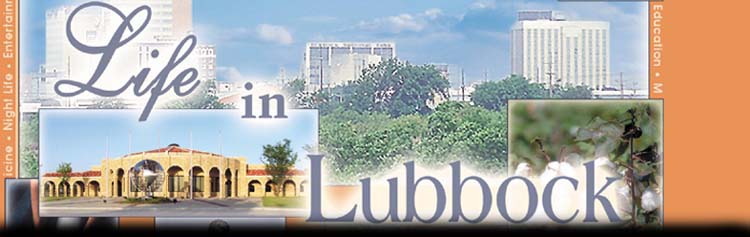
n Depot District: Entertainment district around Buddy Holly Avenue between 17th and 19th streets. Named for the train depot that later became the Depot Restaurant and now houses the Buddy Holly Center.
n Double T: Symbol of Texas Tech. One smaller T stands in front of a larger T.
n Guns up: The hand sign of Texas Tech is made by extending the index finger outward and the thumb upward and tucking in the other fingers. It refers to the idea that the Red Raiders (see below) will shoot down their opponents.
n Hub City: Lubbock's nickname. The Chamber of Commerce adopted the slogan ''Hub of the Plains'' in 1917 to reflect Lubbock's central location in the region and position as a center of commerce.
n Llano Estacado: Means ''Staked Plains'' in Spanish. The southern extension of the High Plains of North America, which lies south of the Canadian River in northwest Texas and northeast New Mexico. A high mesa sloping at a rate of about 10 feet per mile toward the southeast, it is one of the largest tablelands on the north continent.
It is distinctly bounded on the north by the southern escarpment of the Canadian River valley and on the east by the irregular and deeply incised Caprock Escarpment. The western boundary is the Mescalero Escarpment east of the Pecos River valley of New Mexico. The southern end of the plateau lacks a distinct physical boundary, and the Johnson Creek branch of the Colorado River, east of Big Spring, is probably best considered its boundary.
The Llano Estacado includes all or part of 33 Texas and four New Mexico counties and covers about 32,000 square miles. It is part of what was known to early explorers and settlers as the Great American Desert.
The name possibly evolved from references by early explorers to stakes used as markers for travel paths or routes to water. But historians also cite explorers' comparison of the area's cliff formations to palisades, which are large pointed stakes forming a fence, as a possible source of the name.
n The Loop: Common name for Loop 289, which circles the city of Lubbock.
n Overton: Lubbock's oldest neighborhood founded by Dr. M.C. Overton in 1907 and bordered by Avenue Q, Fourth Street, University Avenue and 19th Street. North Overton, north of Broadway, is undergoing a massive revitalization effort.
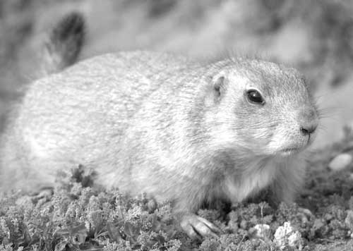
n Prairie Dog Town: A protected colony of prairie dogs inside Mackenzie Park.
n Red Raiders: Name referring to Texas Tech sports teams and students. In a 1932 story, A-J sports writer Collier Parris gave the name to the football team in reference to their red uniforms and strong season. The name caught on, and by 1936 the former name, Matadors, faded away.
n Reese Air Force Base: The base west of town closed in 1997. It has been redeveloped into a research, education and business park named Reese Technology Center.
n South Plains: A physical region within the Great Plains, which lie to the east of the base of the Rocky Mountains and extend into Northwest Texas.
The South Plains is bordered on the north by Hale County and the south by Midland and Ector counties. Its western edge is the state line with New Mexico, and its eastern edge is the Caprock Escarpment.
The A-J commonly refers to its coverage area, the 33 counties surrounding Lubbock and including Lubbock County, as the South Plains.
n Sources: A-J files, The Handbook of Texas Online, ''A History of Lubbock'' by Lawrence L. Graves, Texas Almanac, Texas Tech
Compiled by staff writer Elizabeth Langton